
In the lively drone industry, there’s one course that stands out – Advanced 3D Mapping & Survey. This modern course not only brings you to the forefront of technology but also opens up various job opportunities. It’s an excellent choice if you aim to boost your career.
Exploring the Power of Precision:
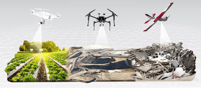
This course focuses on drone technology, teaching you how to capture, process, and use high-quality aerial images to create detailed 3D maps. From city planning to environmental monitoring, this course can change the game in the drone industry.
What You’ll Learn in India:
- Infrastructure Development:
- Help plan and carry out big infrastructure projects.
- Contribute to smart city development through accurate mapping.
- Environmental Monitoring:
- Assess and monitor environmental changes, like deforestation.
- Contribute to conservation efforts with precise data collection.
- Urban Planning:
- Assist city planners in creating detailed maps for efficient urban development.
- Facilitate smart and sustainable urban solutions.
Job Prospects in India:
- Starting Salary:
- Entry-level positions can start from INR 3-6 lakhs per year.
- Salaries may vary based on experience, skills, and industry.
- Job Opportunities:
- The demand for experts in 3D mapping and surveying is rising in India.
- Industries like construction, real estate, and environmental monitoring actively seek skilled individuals.
Course Breakdown:
Day 1: Introduction to 3D Mapping and Surveying
- Basics of 3D mapping and surveying
- Why 3D mapping is important in different industries
- Introduction to surveying tools and techniques
- Basics of data processing and analysis in 3D mapping
Day 2: 3D Modelling
- Detailed study of 3D modelling technique
- Real-world applications of 3D mapping
- Case studies for practical insights
Day 3: Emerging Trends and Future Directions
- New trends in 3D mapping technology
- Future directions in the field
- Quizzes and assignments to test understanding
- Focus on ethics, safety, and regulations in 3D mapping
Day 4: Practical Flying
- Hands-on experience with surveying tools
- Flying exercises using drones or other aerial devices
- Training on data collection in real-world situations
- Emphasis on safety during flying sessions
Day 5: Practical Projects, Final Exam, Assessment, and Certification
- Work on projects applying the knowledge gained
- Final exam to assess overall understanding
- Evaluation of assignments, quizzes, and practical work
- Certification for course completion
In this course, you’ll gain theoretical knowledge and hands-on experience in advanced 3D mapping and surveying. The practical focus, case studies, and projects make it applicable to various industries.
Exploring Advanced 3D Mapping and Surveying:
Dive into the essentials of advanced 3D mapping and surveying. This course covers fundamental concepts and modern technologies to give you a complete understanding. Here’s a summary of what you’ll explore:
- Foundational Understanding:
- Basics of 3D mapping and surveying
- Instrumentation:
- Learn about tools like total stations, GPS, LiDAR, and Photogrammetry
- 3D Modeling and Visualization:
- Understand 3D modelling concepts
- Work with software tools for modelling, texturing, and rendering
- Applications Across Disciplines:
- Implement 3D mapping in urban planning and development
- Use advanced techniques for environmental monitoring
- Preserve historical sites through archaeological mapping
- Real-world Application and Practical Exercises:
- Engage in hands-on exercises for practical experience
- Explore applications in various industries
- Technological Advancements:
- Stay updated on the latest trends in 3D mapping technology
- Challenges and Opportunities:
- Explore current challenges and opportunities in the field
Upon completing this course, you’ll be well-prepared to face real-world challenges in 3D mapping and surveying, staying informed about the latest technological innovations.
Final Thoughts:
Embarking on the journey of Advanced 3D Mapping & Survey in the drone industry isn’t just about technology; it’s about shaping the future. As India advances technologically, professionals in this field become architects of progress, contributing to sustainable development and innovation.
Seize the opportunity to be at the forefront of this technological revolution. Elevate your career with Advanced 3D Mapping & Survey courses, and chart a course towards a future where precision meets progress in the dynamic world of drones. The sky is not the limit; it’s the starting point for those who dare to redefine boundaries.