
In the ever-evolving world of drones, the capabilities of these flying machines continue to soar to new heights. One area where drones are making a significant impact is in 3D mapping and surveying. From construction sites to archaeological digs, drones equipped with advanced technology are revolutionizing how we gather, analyze, and visualize spatial data.
What is 3D Mapping and Surveying?
3D mapping and surveying involve creating detailed, three-dimensional representations of landscapes, structures, and objects. Traditional methods often require time-consuming manual measurements or expensive equipment like helicopters. However, drones offer a cost-effective and efficient alternative.
How Drones Are Changing the Game
Drones are equipped with cameras, sensors, and GPS technology, allowing them to capture high-resolution images and precise location data. Advanced software processes this information to generate accurate 3D models and maps. These models can be used for various purposes, including:
Construction Planning and Monitoring: Drones can survey construction sites regularly, tracking progress and detecting any deviations from the original plan. This real-time monitoring helps project managers make informed decisions and avoid costly delays.
Environmental Monitoring: Drones equipped with specialized sensors can assess environmental factors such as vegetation health, soil erosion, and water quality. This information is invaluable for conservation efforts, land management, and disaster response.
Urban Planning and Infrastructure Management: City planners can use 3D maps generated by drones to analyze traffic patterns, plan infrastructure projects, and optimize urban development. This data-driven approach leads to more efficient and sustainable cities.
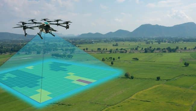
Precision Agriculture: Farmers can benefit from drone-based 3D mapping to monitor crop health, assess soil conditions, and plan irrigation and fertilization strategies. By pinpointing areas that require attention, farmers can maximize yields while minimizing inputs.
Advanced Techniques in 3D Mapping
Recent advancements in drone technology have further enhanced the capabilities of 3D mapping and surveying:
LiDAR (Light Detection and Ranging): LiDAR-equipped drones emit laser pulses to measure distances and create highly detailed elevation maps. This technology is especially useful for mapping complex terrain and dense vegetation.
Photogrammetry: By capturing overlapping images from different angles, drones can create detailed 3D models using photogrammetry software. This technique is ideal for capturing fine details on structures and landscapes.
Artificial Intelligence (AI) and Machine Learning: AI algorithms can analyze drone-captured data to identify objects, classify land cover types, and detect changes over time. This automation streamlines the mapping process and improves accuracy.
Challenges and Considerations
While the benefits of advanced 3D mapping with drones are clear, there are still some challenges to overcome:
Regulatory Compliance: Drone operators must adhere to airspace regulations and obtain necessary permits for commercial mapping activities.
Data Security and Privacy: Collecting and storing large amounts of spatial data raises concerns about privacy and cybersecurity. It’s essential to implement robust security measures to protect sensitive information.
Integration with Existing Workflows: Adopting drone-based mapping technologies requires integration with existing workflows and software systems. Training personnel and ensuring seamless data interoperability are crucial steps in maximizing the value of drone-generated data.
Conclusion
Advanced 3D mapping and surveying with drones represent a significant advancement in the field of geospatial technology. By harnessing the power of drones, industries ranging from construction to agriculture can improve efficiency, reduce costs, and make better-informed decisions. As technology continues to evolve, we can expect drones to play an increasingly vital role in shaping our understanding of the world around us